Catamaran CharterCroatia
Route · 14 days · one-way
Catamaran charter route · Istria

Pomer
via 14 Days.

Sail a 14-day round trip from Marina Pomer: Kvarner crossings, Kornati moonscapes, Krka waterfalls and car-free islands — day-by-day route with mooring tips.

Card image
The route

Day-by-day route

Click any pin on the map or any day in the Route summary below to see the daily stop, narrative, and photos.

Medulin
Day 1

Marina PomerMedulin

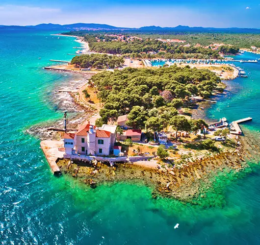
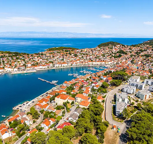
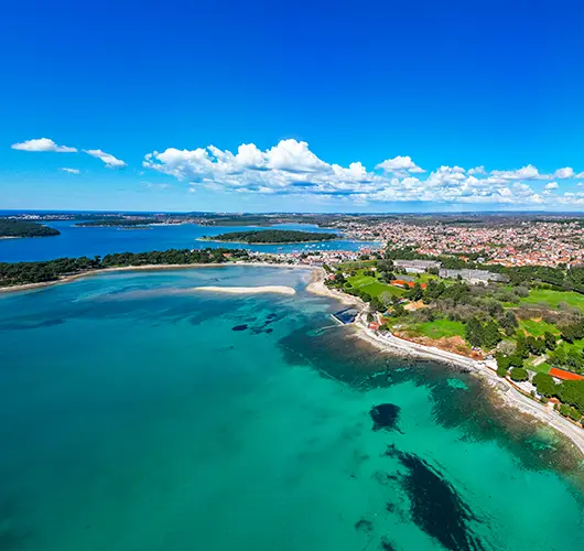
A gentle 3 NM shakedown hop from Marina Pomer around the corner into Medulin bay. Hoist the sails just to test them, thread between the low islets of Ceja and Bodulaš, and anchor over sand with Cape Kamenjak's wild headland in sight for tomorrow's departure.

Distance

1 NM

Sailing

~0.2h at 5 kn

Route at a glance

Best season

May – early October (peak Jun & Sep)

Duration

14 days · Sat – Sat

Departure

Pomer

Sailing area

Istria

Route summary

Click any day to jump back to the map and see its photos, narrative, and mooring tip.

Plan this route

The full story

Day-by-day journey

Named anchorages, restaurants, and route notes for every leg of the week — written by sailors who’ve actually run this passage.

Day 1 / 14
Medulin
1
Day 1

Marina PomerMedulin

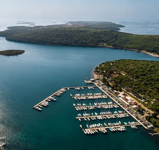
Check-in at Marina Pomer usually wraps up by late afternoon, which is exactly why this first leg is deliberately short. Three miles is enough to run through the boat — furl and unfurl the genoa, test both engines, check the windlass — without any pressure to make distance. Motor out of Pomer's sheltered inlet and turn east into Medulin bay, a broad, shallow basin studded with low green islets. Ceja and Bodulaš are the two you'll pass closest; both are fringed with sand and popular with local swimmers by day, quiet by evening. Depths across much of the bay run 3–5 metres over sand, ideal holding for a first-night anchor test. To the south, the ridge of Cape Kamenjak — Istria's wild, protected southern tip — marks the gate you'll round on tomorrow's crossing. Use the evening to stow provisions properly, brief the crew on winch and helm positions, and get an early night: day two is the longest open-water leg of the trip.

Things to do

Run a full shakedown — sails up, both engines, windlass and instruments checked

Dinghy ashore to Bodulaš or Ceja islet for a first-evening swim

Stroll Medulin's waterfront promenade for last-minute provisions and ice cream

Watch the sun set behind Cape Kamenjak from the trampolines

Mooring tip

Anchor in 3–5 m over sand in the lee of Ceja or Bodulaš — excellent holding, but the bay is open to the south, so check the evening forecast. Marina Pomer is the easy fallback if a southerly is due.
Ilovik
2
Day 2

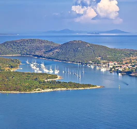
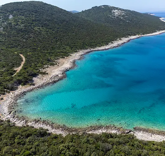
MedulinIlovik

Leave Medulin early — this is the longest passage of the fortnight, and the Kvarner is best crossed before the afternoon breeze builds. Round Cape Kamenjak with respect; wind funnels off the headland, and the seas here are steeper than anywhere else on the route. Once clear, lay a course southeast across open water. Susak appears after roughly 16 NM: a geological oddity of sand and wind-blown loess, terraced with vineyards, with no cars and a village dialect all its own. Drop anchor off its north side for lunch and a swim off the shallow sand shelf. The final 14 NM run brings you to Ilovik, the 'island of flowers', where oleander and eucalyptus line the single village street. The channel between Ilovik and the islet of Sveti Petar is a natural harbour — flat water in almost anything, with a line of mooring buoys and lazy lines along the shore. Dinner ashore feels earned tonight.

Things to do

Anchor off Susak for lunch and a swim above the island's rare sand seabed

Climb through Susak's terraced vineyards to the upper village viewpoint

Walk Ilovik's single waterfront street beneath oleanders and palms

Dinghy across to Sveti Petar islet to find Ilovik's island cemetery among the trees

Mooring tip

Pick up a buoy in the Ilovik–Sveti Petar channel or take a lazy-line berth on the village quay; shelter is near-total, but buoys go fast in July and August, so arrive by mid-afternoon.

Zapuntel, Molat
3
Day 3

IlovikZapuntel (Molat)

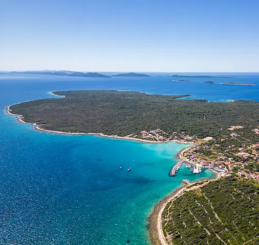
After yesterday's crossing, today is a decompression sail. From the Ilovik channel, head south past Premuda and Škarda into the scatter of low islands that guards the northern Zadar archipelago. The wind here is usually a manageable channel breeze, and with only 14 NM to cover a catamaran can afford to tack lazily rather than motor. Zapuntel is the pass between Molat and Ist — a slot of green water perhaps two hundred metres wide, with the hamlet of the same name on the Molat side. There is almost nothing here: a ferry landing, a handful of stone houses, fig trees, and one of the best-protected anchorages in the entire archipelago. That is precisely the appeal. Swim off the boat, walk the unpaved lane over the hill for views across to Ist, and listen to how quiet it gets after the evening ferry leaves. Cell signal is thin; treat it as a feature.

Things to do

Swim straight off the transom in the strait's clear, current-rinsed water

Walk the lane from Zapuntel over the ridge for views across the Molat channels

Dinghy across the strait to Ist and climb to the hilltop church above the village

Stargaze from the foredeck — there is almost no light pollution here

Mooring tip

Anchor mid-strait in 4–8 m over sand and weed, or use one of the handful of local buoys; the pass is sheltered from every direction, but current runs through it — dig the anchor in well and allow swinging room.

Dugi Otok
4
Day 4

ZapuntelBrbinj (Dugi Otok)

Exit the Zapuntel strait to the south-east and work down through the channels past Molat's inner shore and the long ridge of Sestrunj. These are protected waters — proper island-hopping country, with the mainland Velebit mountains a grey wall on the eastern horizon. Brbinj announces itself as a break in Dugi Otok's wooded coast: a hamlet of stone houses split between two deep inlets, one used by the Zadar ferry, the other quieter and better for anchoring. Ashore it is all olives — some of the groves here are centuries old — and the kind of village where the shop opens when the ferry docks. There are no sights to tick off, which is exactly the point of the middle of this route. Swim, read, walk the coastal path between the two coves, and have a slow dinner aboard. Tomorrow's short leg to Sali means no alarm clock is needed.

Things to do

Walk the shoreline path linking Brbinj's two coves through centuries-old olive groves

Snorkel the rocky edges of the bay, where the water stays glass-clear

Buy local olive oil if a grower has a sign out — it travels well

Paddle the dinghy along the wooded shore as the light softens

Mooring tip

Anchor in the quieter of Brbinj's two coves in 5–10 m over sand and weed, with good protection from the prevailing maestral; keep the ferry quay and its turning circle strictly clear.

Sali
5
Day 5

BrbinjSali

Today barely counts as a passage — 11 NM of coasting along Dugi Otok's eastern shore, past a string of hamlets and pebble coves, with the option to stop and swim anywhere the anchor will hold. Sali has been a fishing port for a thousand years, and it still lands tuna and sardines; the town's summer festival, Saljske užance, celebrates exactly that heritage, complete with the famous 'donkey music' of blown horns. The harbour is a proper working one: fishing boats inside, yachts on the outer quay, konobas grilling the day's catch a few steps from your lines. Top up water and fuel at Zaglav, one bay north, where the petrol station has its own quay — the last easy fuel before the Kornati. Provision here as well; shops inside the national park are scarce and simple. If legs need stretching, the walk over the ridge towards Telašćica gives a first look at tomorrow's scenery.

Things to do

Refuel and top up water at the Zaglav fuel quay before entering the Kornati

Eat grilled fish at a harbourfront konoba — Sali has landed tuna for a thousand years

Provision fully in Sali's shops; the national park has almost none

Walk up over the ridge behind town for a first glimpse of Telašćica

Mooring tip

Go stern-to on Sali's outer quay with lazy lines, or anchor off in the neighbouring cove if the harbour fills; in high season be in by early afternoon — this is everyone's favourite pre-Kornati stop.

Kornati
6
Day 6

SaliPiskera (Kornati)

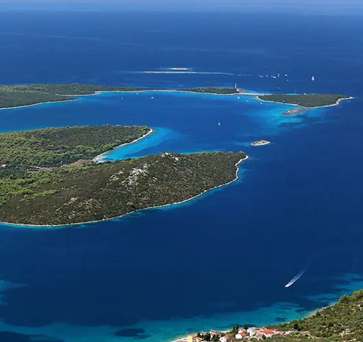
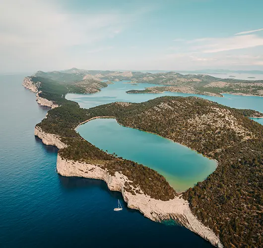
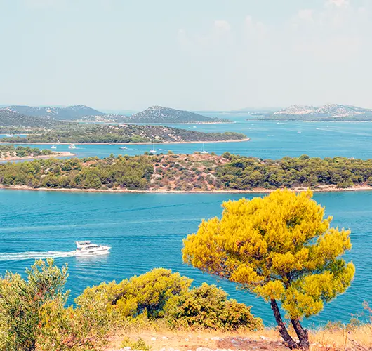
Clear Sali mid-morning and run the short distance south to Mala Proversa, the shallow cut between Dugi Otok and the islet of Katina. Watch the depth here — the dredged channel is narrow, and it carries you from one protected area toward the next: Telašćica Nature Park here, Kornati National Park just beyond. Then the landscape changes completely. The Kornati are limestone laid bare — 89 islands with barely a tree, ribbed with dry-stone walls and grazed to velvet by sheep. George Bernard Shaw's much-quoted line about gods crowning their work with tears and stars was written about exactly this view. Sail the inner channel south-east past Kornat's long shore, then cut across to Piskera. The ACI marina there sits behind the islet of Panitula Vela and is famously spartan: electricity is rationed, water is scarce, and that is part of its charm. The sunset over a thousand stone islets does the rest.

Things to do

Buy Kornati National Park tickets online before you enter — cheaper than on the water

Snorkel the shallows around Panitula Vela, right off the marina

Climb the bare ridge above the pontoons for a 360-degree view of the stone maze

Watch the sunset redden the dry-stone walls of Kornat from the breakwater

Mooring tip

ACI Piskera offers lazy-line berths but water and electricity are limited and there is no fuel; use the southern entrance, as the north side is shallow. Book via the ACI app in season and keep your Kornati park ticket handy — rangers check.

Zlarin
7
Day 7

PiskeraZlarin

Today strings together the best of the Kornati on the way out. From Piskera, work south-east down the chain — if time and weather allow, detour along the seaward side to see the 'crowns', the sheer cliffs where the islands drop into open sea. Popular swim stops such as the bay at Levrnaka lie close to the route. Leaving the park boundary, you cross roughly ten miles of open Adriatic towards the Šibenik islands; on a summer afternoon the maestral will put the catamaran on a fast, comfortable reach. Zlarin greets you with pines and a broad, elegant riva. For four centuries this island supplied Europe with red coral, and a small museum in the village still tells the story; harvesting has long since stopped, but the jewellery tradition survives. There are no cars, one village, and a sheltered harbour bay. Order a cold drink on the waterfront and watch the Šibenik ferry trace its wake home.

Things to do

Detour along the Kornati 'crowns' — the seaward cliffs — before leaving the park

Swim at Lojena bay on Levrnaka, one of the park's rare sandy-bottomed coves

Visit Zlarin's coral centre to see how the island's divers once worked

Walk the pine-shaded riva with an ice cream as the Šibenik ferry comes in

Mooring tip

Berth stern-to on Zlarin's riva or pick up a buoy in the mooring field; the bay opens north-west, so in a fresh maestral arrive early and take the most sheltered inner berths.

Skradin
8
Day 8

ZlarinSkradin

The approach to Šibenik is one of the great pieces of Adriatic pilotage. From Zlarin it is a short hop to the entrance of the St. Anthony channel, a natural cleft barely 140 metres wide at its mouth, guarded by the star-shaped St. Nicholas fortress — Venetian-built in the 16th century and UNESCO-listed. The channel opens abruptly into Šibenik's wide bay, with the dome of the Cathedral of St. James, another UNESCO site, rising above the old town to starboard. Carry on north under the road bridge and the sea becomes a river: the Krka's flooded canyon winds between high green walls, past Prokljan lake, narrowing all the way to Skradin. This small baroque town with its bell tower and café-lined lane is the gateway to the national park. Berth at ACI Marina Skradin, settle in for two nights, and book the morning park boat — tomorrow is for waterfalls, not miles.

Things to do

Photograph St. Nicholas fortress from the water as you enter the channel

Anchor briefly in Prokljan lake for a swim in its warmer, brackish water

Climb to Turina fortress above Skradin for a view down the canyon

Book tomorrow's Krka tickets online tonight and check the first boat time

Mooring tip

ACI Skradin is the practical choice and fills quickly in summer — book ahead; anchoring in the narrow river channel is restricted. The approach is well buoyed, with ample depth all the way up.

NP Krka
9
Day 9

SkradinNP Krka

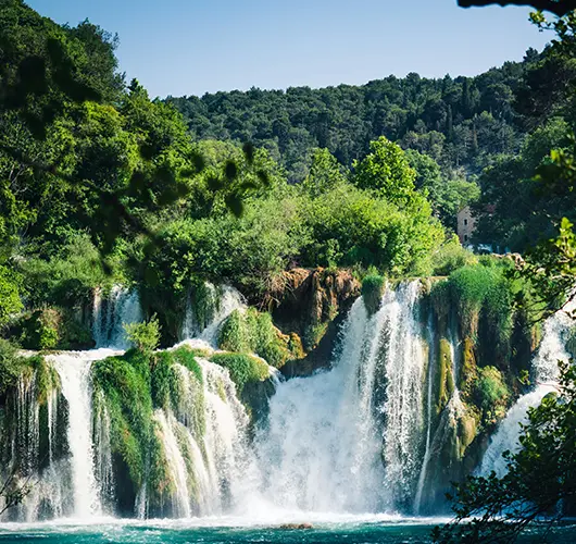
Leave the lines tied today. From Skradin's quay, the national park's own boats run upriver every half hour or so in season, included in the price of the Krka entry ticket — buy it online the night before and take the first departure. Skradinski Buk is the park's showpiece: seventeen travertine steps over which the Krka pours in a wide, glittering staircase, framed by figs and reeds. A loop of wooden boardwalks crosses the pools and channels, passing restored watermills and one of the world's earliest hydroelectric plants, switched on in 1895, just days after Tesla's Niagara scheme. Swimming at the foot of the falls is no longer permitted, so save the swim for the boat. Ambitious crews can extend by shuttle bus or excursion boat to Visovac, the island monastery upstream, or Roški Slap. Back in Skradin by late afternoon, there is time for risotto in a shaded konoba and an ice cream on the riva.

Things to do

Catch the first park boat from Skradin's quay and beat the crowds to Skradinski Buk

Walk the full boardwalk loop past the watermills and the 1895 Jaruga hydro plant

Add the excursion boat to Visovac island monastery if time allows

Order Skradin risotto for dinner — the town's famous slow-cooked speciality

Mooring tip

Keep your ACI Skradin berth a second night and let the office know; if you must move the boat, do it before nine or after six, when the day-tripper wakes have died down.

Murter
10
Day 10

SkradinMurter

Retrace the river in the cool of the morning — the canyon is at its best with the light low and the tour boats still moored. Šibenik slides past to port, and the St. Anthony channel releases you back into open salt water. From there the course runs north-west along a busy, friendly stretch of coast: the fishing harbour of Tribunj with its hilltop chapel, then Vodice, before the Murter channel opens ahead. Murter town and its neighbour Betina have built and sailed wooden boats — gajetas and leuts — for generations; Betina's shipbuilding museum is small but genuinely good, and the yards still smell of pine tar. Kornati owners traditionally farmed their stone islands from here, commuting by boat, which is why Murter still feels like the archipelago's front office. Berth in Marina Hramina on the town's northern bay. Ashore: proper shops for restocking, ice cream on the square, and a swim at Slanica beach if the day is hot.

Things to do

Visit the Betina Museum of Wooden Shipbuilding in Murter's neighbouring village

Swim at Slanica, Murter's sandy town beach, a short walk from the marina

Restock the galley — Murter's shops are the best-supplied in days

Eat peka-baked lamb or octopus in one of Murter's garden konobas

Mooring tip

Marina Hramina offers full services and good all-round shelter — book ahead in season. Anchoring off in the bay works in settled weather but is open to the north-west.

Zadar
11
Day 11

MurterZadar

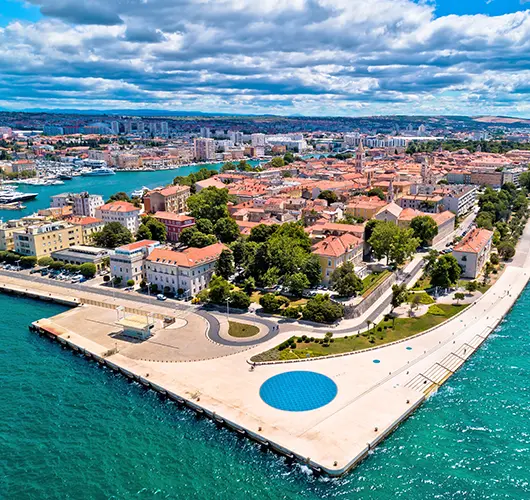
From Murter, thread north-west into the Pašman channel, the sheltered highway between the islands of Pašman and Ugljan and the Dalmatian mainland. It is easy, engaging sailing: monasteries on the island shore (the Franciscans at Kraj, the Benedictines up at Ćokovac), fish farms buoyed off the shallows, and the Zadar ferries to give way to. Emerge into the Zadar channel and the city appears — a Roman colony turned Venetian stronghold on its own narrow peninsula. Zadar rewards a proper walk: the Forum with its standing column, the ninth-century round church of St. Donatus, the Venetian Land Gate, and main streets polished marble-smooth by two millennia of feet. But time your evening for the waterfront. The Sea Organ sighs and chords as the swell pushes air through its underwater pipes, and the Greeting to the Sun light installation flickers to life beside it. Hitchcock called Zadar's sunset the world's most beautiful; judge for yourself from your own deck.

Things to do

Listen to the Sea Organ at dusk, then watch the Greeting to the Sun light up

Walk the Roman Forum and step inside the ninth-century church of St. Donatus

Taste maraschino, the cherry liqueur Zadar has distilled for centuries

Provision at Zadar's green market — the best fresh produce of the whole route

Mooring tip

Berth at Marina Zadar on the peninsula — five minutes' walk from the old town — or at Borik further north; the city quay is dominated by excursion boats. Reserve ahead in July and August.

Silba
12
Day 12

ZadarSilba

Leaving Zadar, the route runs north-west up the channel with the mainland falling away and the islands thinning out: Ugljan, then little Rivanj and Sestrunj, then the open reach past Molat towards Silba. With the afternoon maestral on the beam, a cruising catamaran will eat this leg. Silba was once rich — its captains and shipowners ran cargo under sail across the Mediterranean — and the village still has their solid houses and walled gardens. When steam ended the sailing trade, the island settled into a long nap it has never really woken from: no cars, no hotels of any size, footpaths instead of roads. Climb the Toreta, the freestanding tower with an outer spiral staircase that a lovesick captain is said to have built, for a view over both of the island's bays. Then swim at Šotorišće, the shallow sandy crescent by the harbour, where the water pales to Caribbean colours over the bottom. Dinner options are few and honest; book a table by walking past in the afternoon.

Things to do

Climb the Toreta tower's outer spiral staircase for a two-bay panorama

Swim off the sand at Šotorišće, the island's shallowest, warmest bay

Wander the car-free lanes past sea captains' houses and walled gardens

Watch the sunset from the island's western shore — nothing but sea to the horizon

Mooring tip

Pick up a buoy off Šotorišće or anchor there in 3–5 m over sand; if the wind swings onto the anchorage, swap to the bay on the island's western side — a short hop around the point.

Mali Lošinj
13
Day 13

SilbaMali Lošinj

From Silba the course bends north-west, back through the Ilovik channel you first threaded on day two — the same oleanders, seen now with two weeks of local knowledge. Continue up Lošinj's eastern shore and turn into the long, fjord-like inlet that shelters Mali Lošinj, a harbour so deep and protected it once ranked among the Adriatic's great sailing-ship ports; in the nineteenth century the town's shipyards and captains rivalled anyone on this coast. Today it trades on air instead: Lošinj's pine forests and herb scrub earned it status as a climatic health resort back in Habsburg times, and the town leans into its 'island of vitality' identity with a Fragrant Garden of native plants and a Museum of Apoxyomenos, built around a Greek bronze athlete pulled from the nearby seabed in 1996. Stroll the horseshoe riva, then dinghy or walk over to Čikat bay, where Austro-Hungarian villas stand under the pines. Sleep well — tomorrow closes the loop.

Things to do

Meet the Apoxyomenos, the sea-salvaged Greek bronze, in his own museum on the riva

Walk the pine promenade around Čikat bay past Austro-Hungarian villas

Smell your way around the Fragrant Garden of Lošinj's native herbs

Book a proper farewell-week dinner on the harbour crescent

Mooring tip

Take a lazy-line berth on Mali Lošinj's town quay or a buoy in the harbour; shelter in the long inlet is superb in any wind, but summer demand is high, so call the harbour office ahead.

Marina Pomer
14
Day 14

Mali LošinjMarina Pomer

Slip the lines early and motor down Mali Lošinj's long inlet while the town is still waking. Once clear of Lošinj's southern capes, lay a course north-west across the open Kvarner — the mirror of day two's crossing, and often a better sail, with the morning breeze filling in. Unije and its satellite islets slide close by to starboard; on a clear day the Istrian shore shows early, Cape Kamenjak's low, scrubbed profile marking the way home. Round the cape giving the off-lying shoals respect — the wind often accelerates here — and the final miles into Pomer are flat and easy. Sort fuel as your charter contract requires, then take the last swim of the trip off Ceja or straight from the marina beach. The evening is for sorting photographs, settling the crew kitty, and dinner ashore in Pomer or Medulin. Disembark after breakfast, already arguing about which anchorage deserves the first return visit.

Things to do

Round Cape Kamenjak under sail one last time, cameras ready

Take a final swim off Ceja islet before the lines go ashore for good

Square away fuel and paperwork early, then relax — handover is tomorrow

Toast the crew at a konoba in Pomer or Medulin on your last evening

Mooring tip

Return berths at Marina Pomer are assigned by the charter base — call ahead on VHF or phone and staff will direct you in and take your lines. Arrive by late afternoon, before the returning fleet queues for check-out.

Plan your week

Sail this route — we’ll match a catamaran to it.

Send dates, group size and preferred catamaran style. A broker replies with a tailored quote within hours.